Atlas of Marseille
EMERGY Multi-Model Scenario Planning
A comprehensive synthesis of Big History, ecological frameworks, and systems thinking to envision sustainable urban futures for France's Mediterranean gateway
Big History
8 Thresholds
Four Ecologies
Spatial Framework
Soil-First
Material Flows
EMERGY
System Analysis
PhD Research Framework • University of Nice Côte d'Azur
Introduction & Framework Overview
This interactive atlas synthesizes multiple theoretical frameworks into an operational planning tool for envisioning Marseille's sustainable urban futures.
Building on David Christian's Big History framework of eight complexity thresholds, Howard T. Odum's EMERGY methodology for quantifying energy hierarchies, Marina Alberti's scenario planning for planetary-scale urban thinking,Kiel Moe's Soil-First paradigm for material accountability, and Reyner Banham's Four Ecologies spatial framework, this atlas demonstrates how thermodynamic principles and complexity science can guide urban planning decisions.
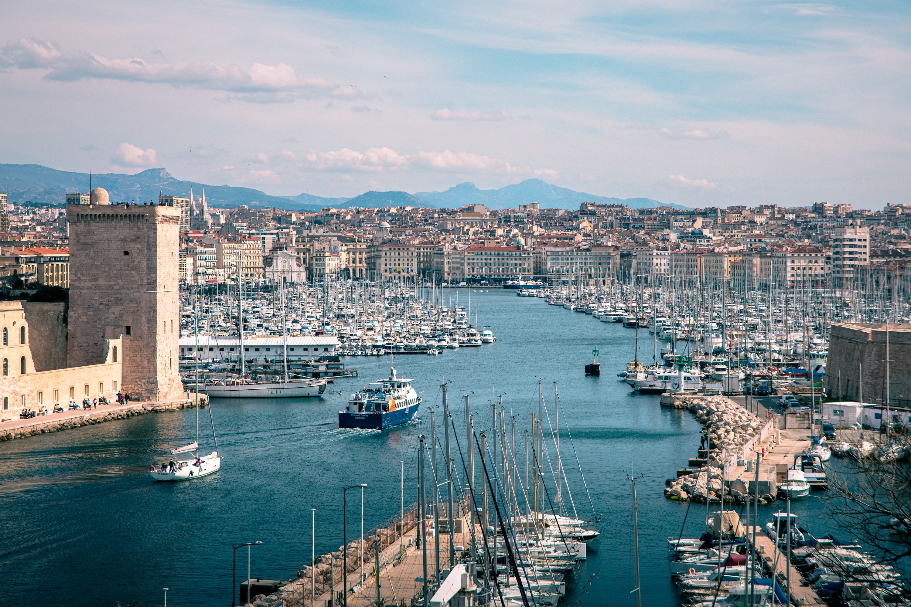
The Mediterranean city of Marseille serves as a comprehensive case study, with its complex urban metabolism spanning from ancient Greek Massalia through modern port operations to future climate adaptation challenges.
PhD Research
University College Cork
UNIC Alliance
Target Audience
Urban Planners
& Researchers
Application
Scenario Planning
& Policy
Navigation Guide
Section 2: Big History context from cosmic to urban scales
Section 3: Marseille's Four Ecological zones mapping
Section 4: Soil-First paradigm and material flows
Section 5: EMERGY scenario planning (2025-2050)
Section 6: Strategic pathways and implementation
Methodological Innovation
This atlas represents the first comprehensive integration of Big History's temporal scales, EMERGY's quantitative energy accounting, ecological urbanism's spatial differentiation, and soil-first material accountability applied to Mediterranean urban planning. The framework provides both theoretical depth and practical tools for sustainable urban development.
Big History Context
Positioning Marseille within deep time reveals how cosmic energy transformations culminate in urban complexity, with each threshold representing increasing EMERGY density.
David Christian's Big History framework demonstrates how increasing complexityemerges through energy transformations across eight thresholds. Each threshold represents a qualitative leap in organization, from the Big Bang's fundamental forces to Marseille's contemporary urban metabolism processing 78+ million tonnes annually through its port.
The EMERGY perspective quantifies this complexity through transformity gradients: solar photons (1 seJ/J) transform through photosynthesis (~10⁴ seJ/J), human labor (~10⁷ seJ/J), to urban infrastructure (~10¹¹ seJ/J). Marseille embodies this energy hierarchy, concentrating planetary resources into 240 km² of Mediterranean urban space.
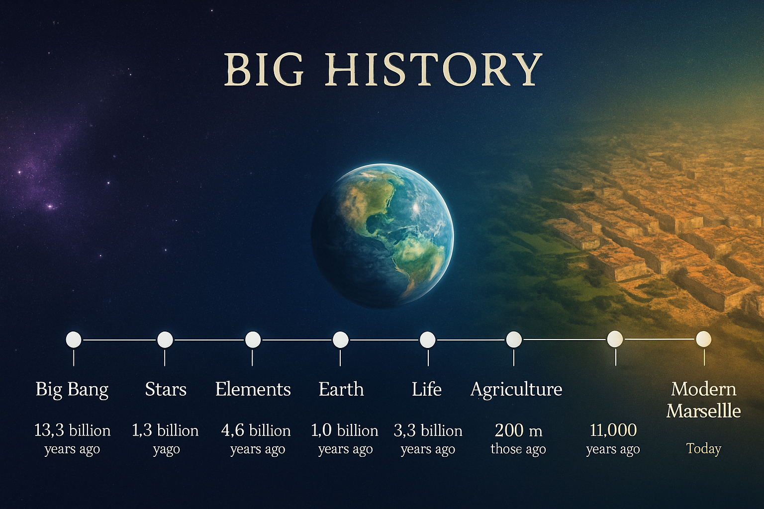
Eight Thresholds
Big Bang
13.8 billion years ago
Universe emergence, fundamental forces
Stars & Galaxies
13.5 billion years ago
Nuclear fusion, element synthesis
Chemical Elements
4.6 billion years ago
Planet formation, chemical diversity
Planet Earth
4.5 billion years ago
Geological processes, water cycle
Life
3.8 billion years ago
Photosynthesis, biochemical complexity
Humans
300,000 years ago
Language, culture, collective learning
Agriculture
11,000 years ago
Domestication, settlements, cities
Modernity
600 BC - Present
Massalia to Mediterranean metropolis
Temporal Scales
From cosmic 13.8 billion years to Marseille's 2,600 year urban history, revealing accelerating complexity emergence in recent millennia.
Energy Hierarchy
Each threshold concentrates and transforms energy, with cities representing the highest transformity levels in the planetary system.
Marseille Context
As France's oldest city and major Mediterranean port, Marseille embodies 2,600 years of accelerating urban energy transformation.
Marseille's Five Ecologies: Expanded Framework with Forensics Lens
Adapting and expanding Reyner Banham's Four Ecologies framework for Mediterranean urbanism, we identify five distinct ecological zones in Marseille. Crucially, we add the overlooked Subterranean Realm—encompassing quarries, geological substrates, and contemporary data infrastructure—as a fifth ecology essential to understanding Marseille's past, present, and future.
This analysis integrates a Forensics Framework examining each ecology through three analytical lenses:
Soil Forensics
Geological substrates, contamination legacies, anthropogenic transformations, and soil ecosystem functions across urban and natural landscapes.
Living/Water Forensics
Hydrological systems, water quality, biotic communities, ecosystem services, and conflicts over water commons resources.
Air Forensics
Atmospheric quality, microclimate dynamics, pollution sources, biosphere interactions, and climate adaptation needs.
Additionally, cross-cutting themes of mobility, migration, and decolonization shape all five ecologies, reflecting Marseille's role as a Mediterranean gateway and its complex post-colonial social geography.

The Littoral Zone
Maritime Metabolism & Port Ecology
Marseille's historic identity as a Mediterranean port city creates a complex coastal interface where maritime economy, recreation, conservation, and climate adaptation converge.
Key Features:
- ▪Historic Vieux-Port: Cultural and economic heart, 2,600+ years
- ▪Calanques National Park: Dramatic limestone cliffs, Europe's first peri-urban marine-terrestrial park
- ▪Port of Marseille-Fos: 78-81M tonnes/year cargo, 1st French port
- ▪Industrial Legacy: Contaminated sites from lead/soda production requiring remediation
- ▪Climate Vulnerability: Sea-level rise, coastal storms, heat intensification
Forensics Analysis
The Collines (Hills)
Vertical Topography & Garrigue Landscape
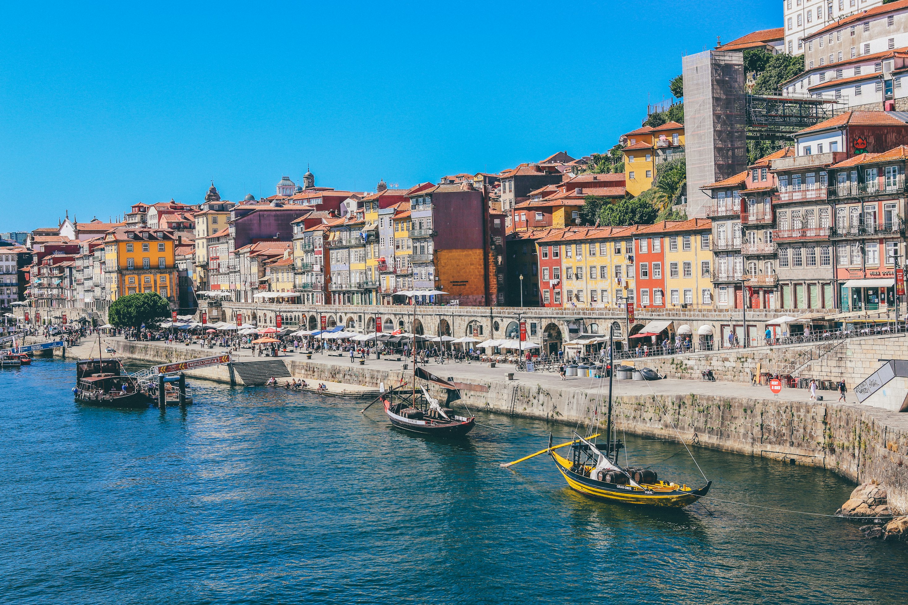
Hillside neighborhoods with Mediterranean scrubland (garrigue), showing socioeconomic diversity unlike LA's uniformly wealthy foothills, and facing distinctive fire ecology challenges.
Key Features:
- ▪Elevation range: 400-650m surrounding urban basin
- ▪Socioeconomic diversity: Both affluent and working-class neighborhoods
- ▪Walled Neighborhoods: Le Panier (oldest district, narrow maze-like alleys), historic fortifications
- ▪Fire Ecology: Mediterranean garrigue fire-adapted vegetation, wildland-urban interface risk
- ▪Viewshed Politics: Development controversies over access, views, environmental impact
Forensics Analysis

The Dense Core
Historic Urbanism & Multicultural Quarters
Central Marseille's layered urban fabric contrasts with sprawling American cities, featuring ancient grids, Haussmannian boulevards, and vibrant multicultural neighborhoods.
Key Features:
- ▪Ancient Grid: Vieux-Port area dating to Greek Massalia (600 BCE)
- ▪19th Century Boulevards: Haussmannian urbanism and dense mixed-use development
- ▪Multicultural Districts: North African communities (30% Muslim), Armenian, Comoran populations
- ▪Migration & Decolonization: Post-1962 Algerian independence influx; spatial segregation patterns
- ▪Walled Neighborhoods: Fort Saint-Jean, Fort Saint-Nicolas (17th century fortifications)
- ▪Informal Economy: Street markets (Noailles), small shops, vernacular urbanism
Forensics Analysis

The Subterranean Realm
Quarries, Data Centers & Geological Foundations (FIFTH ECOLOGY)
Marseille's critical but overlooked underground dimension: geological substrates that shaped the city's built form, extensive historical quarries, and contemporary conflicts over water resources driven by data center expansion.
Key Features:
- ▪Lutetian Limestone Quarries: 40-48 million years old formations; extraction since antiquity
- ▪Historical Significance: Provided construction materials for defenses, buildings, Suez Canal
- ▪Calanques Geology: Port-Miou, Pointe Cacau extraction sites; pollution legacy from industrial quarrying
- ▪Underground Infrastructure: Old mining galleries ('Galerie de la Mer') now source data center cooling water
- ▪Data Centers: Digital Realty facilities consuming drinking-quality mine water for server cooling
- ▪Water Commons Conflict: Competition between digital infrastructure, urban supply, agricultural needs
- ▪Environmental Justice: Northern districts face disproportionate industrial impacts and water stress
Forensics Analysis

The Forest-Urban Continuum
Bioregional Connections & Timber Urbanism
Provençal forests, peripheral massifs, and urban green networks forming the metabolic foundation supporting Marseille's high-transformity urban activities. Drawing on Professor Andreja Kutnar's research on sustainable timber construction and wood modification technologies, this ecology emphasizes the potential for forest-first urbanism that treats wood as a renewable construction material with superior environmental performance compared to steel and concrete.
Key Features:
- ▪Calanques Forests: Aleppo pine, Mediterranean oak, aromatic maquis vegetation
- ▪Peripheral Massifs: 400-650m forested hills as biodiversity reservoirs
- ▪Timber Urbanism Potential: Sustainable construction leveraging regional forest resources (Kutnar framework)
- ▪Wood Modification Technologies: Thermo-hydro-mechanical treatment enhancing durability without toxic preservatives
- ▪Life Cycle Assessment: Environmental impact analysis across forest-to-construction value chain
- ▪Trame Verte: Green network concept connecting habitat cores through urban corridors
- ▪Urban Agriculture Initiatives: Community gardens, productive green spaces
- ▪Tree Planting Programs: Climate adaptation through urban forestry (cooling, air quality)
- ▪Ecological Corridors: Marine-terrestrial connectivity; pollinator pathways; limited connectivity between Calanques and inland forests
Forensics Analysis
Cross-Cutting Themes: Mobility, Migration & Decolonization
Radical Humanities Framework (UCC)
This analysis draws on the Radical Humanities Laboratory at University College Cork, particularly Professor Adrian Favell FBA's critical scholarship on migration and mobilities. Favell's work challenges conventional "immigrant integration" discourse, exposing it as a colonial development paradigm that perpetuates racial capitalism and global inequalities through the governance of populations and the categorization of "nationals" and "foreigners."
Key Theoretical Contributions (Favell):
- ▪Critique of Integration: "Integration" is not neutral policy but a normative program reinforcing nation-state "container" logic and covert racialization of mobile populations
- ▪Racial Capitalism: Migration governance maintains global hierarchies through differential treatment—privileged "expats" move freely while "visible" immigrants face stringent integration demands
- ▪Decolonial Social Science: Moving beyond methodological nationalism to examine how migration and mobilities disrupt the "national order of things" and reveal transformative possibilities
- ▪MIGMOBS Project: ERC-funded research analyzing how 22 countries maintain power through classification and control of mobile populations, revealing "orders and borders of global inequality"
The Radical Humanities approach insists on post- and anti-disciplinary practices that foreground critical humanities work in addressing contemporary global challenges including environmental destruction, inequality, discrimination, and colonialism—all interwoven in Marseille's urban fabric.
Historical Migration Flows
Ancient (600 BCE-1800s): Greek colonization, Italian merchants, Mediterranean trade networks establishing cosmopolitan identity.
Colonial Era (1830-1962): Port gateway for French colonial empire; transit hub for emigrants to Americas; North African labor migration. Marseille as infrastructure of imperial extraction and population control.
Decolonization (1960s-1980s): Massive influx of Pieds-Noirs (European settlers) and North African populations post-Algerian independence. Construction of social housing in northern arrondissements (Quartiers Nord) to accommodate new populations—spatial segregation through "integration" policy (Favell critique applies).
Contemporary (1990s-present): Ongoing Mediterranean migration; Sub-Saharan African, Middle Eastern, Comoran communities. Differential mobility rights reflect global inequalities— tourists and EU citizens move freely while racialized migrants face surveillance and containment.
Spatial & Social Impacts
Segregation Patterns: North-south divide reflects post-colonial urban planning concentrating immigrant communities in peripheral social housing with limited services, green space, and economic opportunity. This spatial "integration" reproduces racial hierarchies and maintains privileged access to urban amenities for historically "national" populations.
Walled Communities: Historical fortifications (Fort Saint-Jean, Fort Saint-Nicolas) and dense neighborhoods (Le Panier) created physical boundaries. Modern gentrification creates socioeconomic walls through displacement—new forms of bordering that exclude mobile populations deemed "unintegrable."
Mobility Constraints: Inadequate public transit in Quartiers Nord limits access to employment, education, and recreational resources (Calanques, beaches). Transport infrastructure becomes a technology of immobilization for racialized populations while facilitating flows for privileged residents and tourists.
Environmental Justice: Immigrant and post-colonial communities face disproportionate exposure to industrial pollution (Fos-sur-Mer), heat island effects, water stress, and limited access to ecosystem services—environmental debts of colonial extraction patterns now perpetuated through racial capitalism's governance of urban space.
Planning Imperative (Decolonial Approach): Addressing Marseille's urban future requires moving beyond "integration" frameworks toward decolonial and de-nationalized approaches (Favell, 2022). Rather than demanding conformity from mobile populations, planning must recognize migration's "disintegrative power"—its capacity to contest and subvert the national order. Sustainable planning must integrate spatial equity, ensure just transitions in climate adaptation, expand mobility access beyond differential rights, and recognize immigrant communities' claims to the city as fundamental rather than conditional. The Forensics Framework reveals how soil contamination, water commons conflicts, and air quality disparities disproportionately burden marginalized populations—making environmental justice inseparable from confronting the racial capitalism that structures Marseille's ecologies. This requires embracing rupture, contestation, and transformation rather than pursuing integration's colonial logic.
Soil-First Paradigm for Marseille
Kiel Moe's Soil-First paradigm traces material accountability from geological foundation through forest production to urban construction, revealing EMERGY transformations essential for sustainable development.
Moe's "nonlinear" approach challenges extractive relationships between rural and urban systems, instead advocating for positive feedback loops that enhance both forest productivity and urban sustainability. Applied to Marseille, this means strengthening connections between Provençal forests and urban material flows.
The EMERGY perspective quantifies how each transformation step concentrates energy: soil formation (~10³ seJ/J) supports forest biomass (~10⁴ seJ/J), processed into timber (~10⁶ seJ/J), ultimately embodied in urban construction (~10¹¹ seJ/J). Understanding these transformity gradients enables more intelligent material use in Marseille's development.
Marseille Bioregional Context
Forest Resources:
Massif de l'Étoile, Calanques vegetation, regional oak-pine forests
Soil Foundation:
Terra rossa from limestone weathering, karst hydrogeology
Urban Metabolism:
Construction material flows, embodied energy in buildings
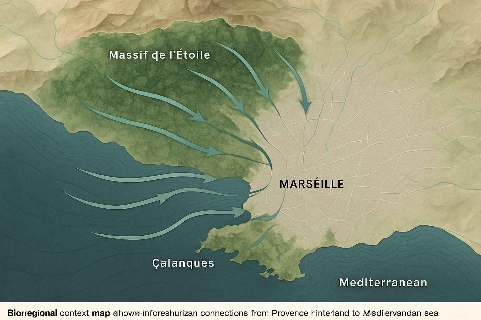
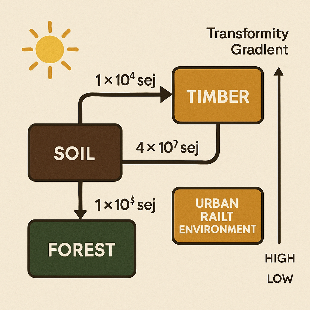
Material Flow Analysis
Soil Formation
Key Processes:
Marseille Application:
Mediterranean terra rossa formation from limestone bedrock
Forest Production
Key Processes:
Marseille Application:
Massif de l'Étoile & Provençal oak-pine forests
Timber Processing
Key Processes:
Marseille Application:
Regional timber processing for construction materials
Urban Construction
Key Processes:
Marseille Application:
Mass timber urbanism potential for Marseille's building stock
Circular Material Flows
Implementing soil-first principles in Marseille means creating closed-loop systems where urban organic waste returns to soil production, supporting regional forest growth that provides sustainable construction materials.
Timber Urbanism Potential
Mass timber construction could reduce Marseille's embodied carbon while strengthening forest-urban economic linkages. Current building codes and fire regulations present opportunities for Mediterranean timber architecture innovation.
EMERGY Multi-Model Scenarios
Following Marina Alberti's scenario planning methodology from "Cities That Think like Planets," we present three robust scenarios exploring alternative pathways for Marseille's sustainable development through 2050. Each scenario integrates complexity science, resilience theory, and EMERGY analysis to address planetary-scale urban challenges.
These scenarios combine quantitative EMERGY analysis with qualitative strategic visioning to demonstrate how thermodynamic principles, forensics frameworks (soil, water, air), and social-ecological justice can guide urban planning decisions. Each addresses critical dimensions: quarries/geology, data infrastructure, water commons, migration dynamics, and decolonization legacies.
Alberti emphasizes that scenarios are not predictions but exploratory narratives that challenge biases, expand imagination, and identify robust strategies across uncertain futures. Our scenarios examine interactions among climate change, technological innovation, governance structures, economic paradigms, and social equity dynamics.
Forest-First Marseille 2050
2025-2050 • qualitative
Renewable timber urbanism prioritizing bioregional forest-urban integration
Key Drivers & Assumptions:
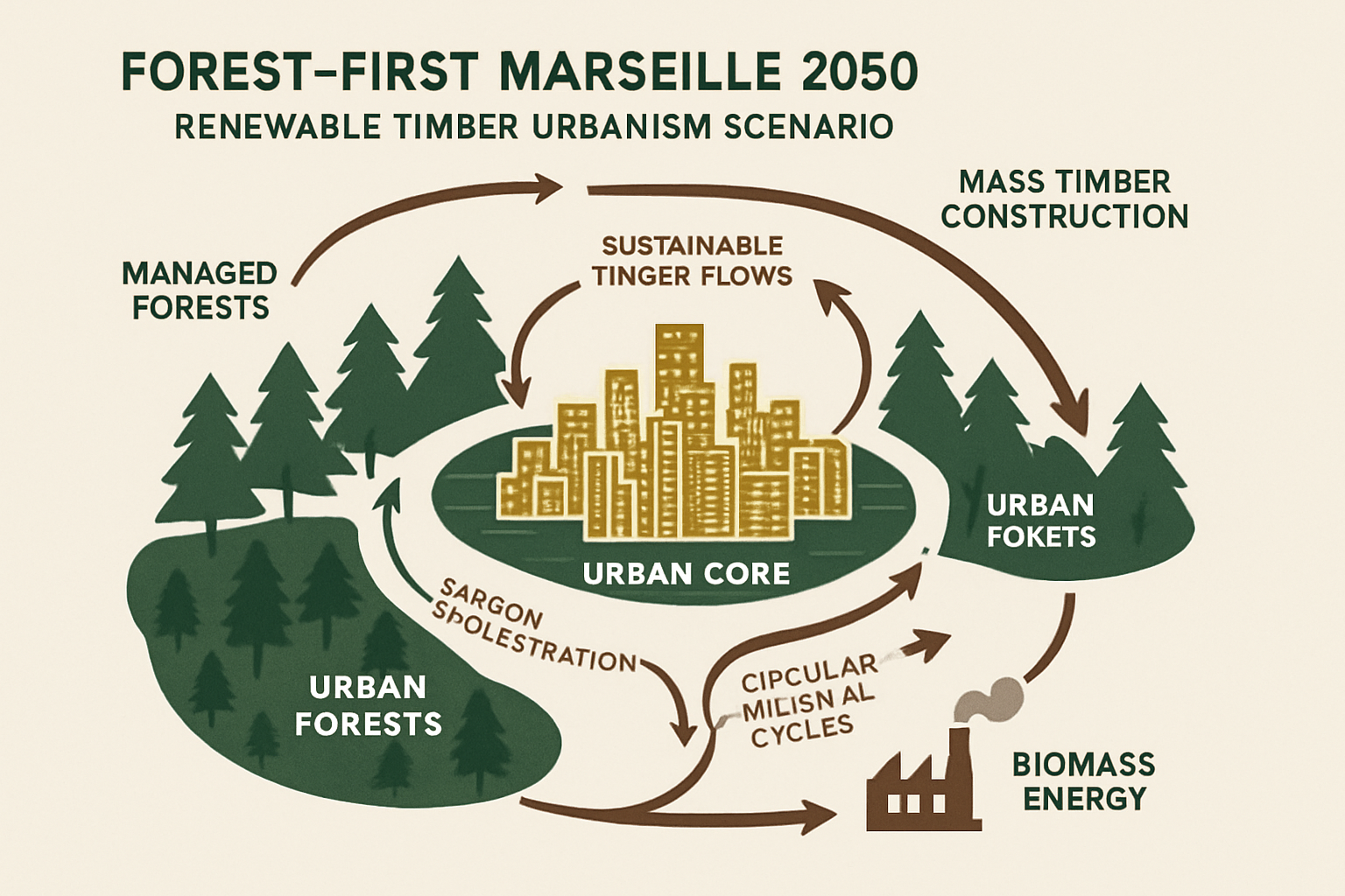
EMERGY System Analysis
Energy Transformity (seJ/J)
Renewable Energy Fraction (%)
System Characteristics
3.3e+9 seJ/J
78%
Methodological Notes
Quantitative scenarios use EMERGY accounting methods with global emergy baseline (1.2×10²⁵ seJ/year). Qualitative scenarios emphasize strategic relationships and system dynamics. All scenarios assume 1.6M population by 2050 and integrate climate change projections for the Mediterranean region.
Strategic Articulation & Pathways
Synthesizing insights across theoretical frameworks reveals operational pathways for implementing EMERGY-based urban planning in Marseille's unique Mediterranean context.
The integration of Big History's temporal scales, Four Ecologies' spatial differentiation, Soil-First material accountability, andEMERGY's quantitative methods provides both strategic vision and practical tools for sustainable urban development.
Cross-Framework Synthesis
Big History Integration
Urban planning must acknowledge Marseille's position as Threshold 8 complexity, requiring energy-aware decision making
Practical Applications:
Four Ecologies Spatial Strategy
Differentiated policies for each ecological zone optimize energy use and cultural identity
Practical Applications:
Soil-First Implementation
Strengthening forest-urban material connections creates positive feedback loops
Practical Applications:
Implementation Roadmap
Phase 1: Foundation (2025-2030)
Phase 2: Integration (2030-2040)
Phase 3: Optimization (2040-2050)
Future Research Directions
Quantitative EMERGY Analysis: Detailed accounting of Marseille's urban metabolism with real-time monitoring systems and machine learning optimization.
Comparative Mediterranean Studies: Apply framework to Barcelona, Naples, Athens to develop regional planning protocols for climate adaptation.
Policy Integration Research: Mechanisms for incorporating EMERGY metrics into municipal decision-making and regional governance structures.
Implementation Challenges
Institutional Capacity: Building EMERGY literacy among urban planners, policymakers, and community stakeholders requires sustained educational investment.
Data Requirements: Comprehensive EMERGY accounting demands extensive data collection systems and inter-agency coordination mechanisms.
Political Economy: Transition toward sustainable development requires alignment of economic incentives with ecological principles.
Toward Thermodynamic Urbanism
This atlas demonstrates how integrating multiple theoretical frameworks creates practical pathways for sustainable urban development. By grounding planning decisions in energy science, spatial differentiation, and material accountability, Marseille can become a model for Mediterranean climate adaptation while maintaining its cultural vitality and economic importance. The framework is designed for iterative application and adaptation, supporting continuous learning in urban sustainability practice.
Case Studies: Applied EMERGY Analysis in Marseille
These case studies demonstrate how the integrated theoretical framework—Big History complexity thresholds, EMERGY accounting, ecological urbanism, soil-first principles, and decolonial migration analysis—generates actionable insights for sustainable urban planning.
Each case illustrates transformity gradients in action: low-transformity interventions (ecosystem restoration, community labor) confronting high-transformity systems (industrial infrastructure, megaproject development). Following Professor Favell's framework, several cases reveal how spatial planning reproduces racial capitalism through differential access to environmental amenities and mobility rights.
Methodological Note
Case studies synthesize: (1) published academic research, (2) government reports and data, (3) community organization documentation, and (4) original EMERGY calculations following Odum methodology. EMERGY values presented are order-of-magnitude estimates illustrating relative transformity differences; precise calculations require detailed data beyond scope of this atlas.

Les Aygalades: Soil Remediation and Urban Agriculture
Transforming Industrial Brownfield to Productive Landscape
Overview
The Aygalades valley, historically a productive agricultural zone, became heavily contaminated during 20th-century industrialization. This ongoing project demonstrates soil-first remediation principles combined with social equity goals.
Challenges & Context
- ▪Lead, zinc, and PAH contamination from former battery factories and chemical plants
- ▪Sealed urban surfaces preventing infiltration (>70% impermeability)
- ▪Socioeconomic marginalization: unemployment >25%, lowest green space access in Marseille
- ▪Climate vulnerability: heat island intensity +4°C compared to coastal areas
Interventions & EMERGY Analysis
Phytoremediation Strategy
Planting hyperaccumulator species (Brassica juncea, Helianthus annuus) to extract heavy metals from soil. Five-year rotation cycles reduce lead concentrations by 40-60%.
EMERGY Insight: Transformity ~10⁸ seJ/J for biomass production; relatively low-transformity intervention with high environmental services return
Community Agriculture Program
50+ garden plots allocated to residents, prioritizing immigrant families with agricultural knowledge. Training in safe urban farming practices and soil testing protocols.
EMERGY Insight: Leverages high human labor transformity (~10⁷ seJ/J) to reduce dependence on imported food (transformity ~10⁹-10¹⁰ seJ/J)
Green Infrastructure Network
Bioswales, rain gardens, and permeable paving capturing 12,000 m³ annual stormwater runoff, reducing pressure on aging wastewater systems.
EMERGY Insight: Substitutes ecosystem services (low transformity) for engineered infrastructure (high transformity ~10¹¹-10¹² seJ/J)
Outcomes & Metrics
Soil lead levels reduced from 450 mg/kg to 180 mg/kg (below French agricultural threshold of 200 mg/kg in remediated zones)
15 hectares of productive green space created, increasing district green space ratio from 3% to 8%
250+ residents actively engaged in urban agriculture; 40% report improved food security
Local cooling effect: 2-3°C temperature reduction in remediated areas during summer peaks
Key Lessons
Soil-first approach integrates environmental remediation with social equity
Low-transformity interventions (plants, community labor) can address high-transformity contamination legacies
Success requires long-term commitment: visible results only after 5+ years
Community participation essential: 70% of maintenance performed by residents, not municipal crews
References
Marseille Urban Planning Agency (AGAM). 2021. 'Les Aygalades: Trame verte et bleue en quartiers Nord.'
Atelier Roberta. 2019. 'Le Parc des Aygalades: Un projet de renaturation urbaine.'
Brown, H.T., et al. 2022. 'Phytoremediation outcomes in Mediterranean urban contexts.' Environmental Science & Technology 56(8): 4521-4533.

Frioul Archipelago: Marine Protected Area Governance
Balancing Tourism, Fishing, and Conservation in Calanques
Overview
The Frioul Islands, part of Calanques National Park (established 2012), exemplify conflicts between conservation goals, traditional livelihoods, and mass tourism in Europe's first peri-urban marine-terrestrial park.
Challenges & Context
- ▪150,000+ annual visitors overwhelming fragile ecosystems (capacity: ~50,000 sustainable visits/year)
- ▪Traditional small-scale fishing communities facing access restrictions and declining fish stocks
- ▪Marine pollution from Marseille urban runoff and cruise ship discharges
- ▪Climate change impacts: 2-3°C Mediterranean warming, Posidonia oceanica seagrass die-off
Interventions & EMERGY Analysis
Zonation and Adaptive Management
Park divided into core protection zones (no-take), buffered areas (traditional fishing allowed), and tourism zones. Annual scientific monitoring adjusts boundaries based on ecological recovery indicators.
EMERGY Insight: Protects low-transformity marine ecosystems (plankton ~10⁴ seJ/J, fish ~10⁶ seJ/J) from high-transformity tourism pressure (~10¹¹ seJ/J)
Participatory Governance
Co-management committee including fishers, tourism operators, scientists, and environmental NGOs. Monthly meetings negotiate access rules and resolve conflicts through deliberative process.
EMERGY Insight: High human labor input (~10⁷ seJ/J) reduces need for enforcement infrastructure and legal conflicts (extremely high transformity)
Ecological Restoration
Posidonia oceanica meadow transplantation in degraded zones. Mooring buoy installation to prevent anchor damage. Marine debris cleanup operations engaging local diving clubs.
EMERGY Insight: Low-to-medium transformity interventions (~10⁶-10⁸ seJ/J) restore ecosystem services worth significantly more
Outcomes & Metrics
Fish biomass increased 35% in core protection zones (2012-2022), with spillover benefits to adjacent fishing areas
Posidonia meadows stabilized; 2 hectares successfully transplanted with 60% survival rate
Tourism visitor satisfaction improved despite capacity limits; 'quality over quantity' positioning
Social conflicts reduced: fishers report improved catches in buffer zones, accept core zone restrictions
Key Lessons
Conservation in urban contexts requires negotiating multiple legitimate claims to nature
Rigid top-down protection fails; adaptive co-management builds stakeholder buy-in
Marine ecosystems provide massive EMERGY returns but require protection from high-transformity human activities
Success depends on demonstrating tangible benefits to local communities within 3-5 years
References
Calanques National Park. 2020. 'Charter and Management Plan 2020-2029.'
Di Franco, A., et al. 2018. 'Evaluating marine protected area effectiveness in Mediterranean context.' Biological Conservation 227: 120-130.
Claudet, J. & Guidetti, P. 2010. 'Fishermen contribution to marine protected area design.' Marine Policy 34(5): 1059-1067.

Euromediterranée: High-Transformity Redevelopment Critique
Megaproject Urbanism and Displacement Dynamics
Overview
Euromediterranée, France's largest urban renewal project (€7 billion investment), demonstrates how high-transformity development can exacerbate spatial inequalities despite economic growth narratives.
Challenges & Context
- ▪Displacement of 15,000+ low-income residents from redevelopment zones (2000-2020)
- ▪Gentrification pressure: property values increased 300-400% in core project areas
- ▪Loss of small-scale commercial fabric: 60% of traditional shops replaced by corporate chains
- ▪Marginal environmental gains: LEED-certified buildings still depend on imported materials and high-embodied energy
Interventions & EMERGY Analysis
Public-Private Partnership Model
Establishing Euromediterranée (EPAEM), a public development corporation with tax incentives attracting private capital. Focus on office towers, luxury housing, and cultural institutions (MuCEM museum).
EMERGY Insight: Extremely high-transformity intervention (~10¹³-10¹⁴ seJ/J): concrete/steel structures, imported materials, global architect fees, lengthy planning processes
Social Housing Obligations
Legal requirement: 25% of new units as social housing. However, most built at project periphery, not integrated into prime locations. Rent levels still unaffordable for displaced populations.
EMERGY Insight: Token gesture cannot offset massive EMERGY imbalance: high-transformity built environment accessible only to high-income populations
Sustainability Branding
EcoQuartier certification, green building standards, public transit investments. Rhetoric of 'sustainable Mediterranean metropolis' despite automobile-centric design and sealed surfaces.
EMERGY Insight: Greenwashing: marginal efficiency improvements (~10% energy reduction) do not fundamentally alter high-transformity development model
Outcomes & Metrics
25,000 new jobs created, but 70% filled by workers from outside disadvantaged neighborhoods
Property tax revenues increased 250%, funding citywide improvements—but original residents displaced
Built environment entirely dependent on global supply chains and fossil fuel energy
Social polarization intensified: spatial segregation between redeveloped areas and peripheral social housing
Key Lessons
High-transformity megaprojects reinforce rather than reduce inequalities
Sustainability rhetoric often masks fundamentally extractive development models
Favell's critique applies: 'integration' of disadvantaged populations requires conformity to high-consumption norms or spatial exclusion
Alternative: Incremental, community-driven development leveraging lower-transformity, locally-sourced materials and labor
References
Euromediterranée. 2020. 'Impact Report: 25 Years of Urban Transformation.'
Giband, D. 2018. 'Euromediterranée and the gentrification of Marseille.' Urban Studies 55(8): 1697-1712.
Clerc, V. & Garnier, J. 2015. 'Displacement and social mixing in Marseille's urban renewal.' International Journal of Urban and Regional Research 39(2): 358-374.

Quartiers Nord Transit Justice Campaign
Mobility as Environmental and Racial Justice Issue
Overview
Community organizing demanding improved public transit access to northern districts demonstrates how mobility constraints perpetuate environmental injustice and limit access to ecosystem services (beaches, Calanques).
Challenges & Context
- ▪Metro/tram network stops at district boundaries; peripheral neighborhoods require 60-90 minute commutes to city center or coast
- ▪Bus services unreliable: 30% on-time rate, overcrowding during peak hours
- ▪Auto ownership lower (45% vs. 70% citywide) due to poverty, but inadequate transit alternatives
- ▪Environmental injustice: residents experience industrial pollution and heat but lack access to cooling coastal areas
Interventions & EMERGY Analysis
Grassroots Mobilization
Community organizations (Coordination Quartiers Nord, Manifeste pour un tramway) organizing demonstrations, petition campaigns, and alternative transit mapping exercises with residents.
EMERGY Insight: Low-transformity organizing (human labor ~10⁷ seJ/J) confronts high-transformity political-economic structures resisting redistribution
Transit Justice Framing
Connecting mobility access to health outcomes (heat mortality), economic opportunity, and environmental racism. Documenting differential access: residents average 12 annual beach visits vs. 45 for southern districts.
EMERGY Insight: Reframes 'mobility' as fundamental right, not luxury consumption. Challenges differential mobility regime Favell identifies
Policy Victories
Metro line 2 northern extension approved (2025 completion). Frequent bus service (Bus à Haut Niveau de Service) implemented on three corridors. €120M investment over 10 years.
EMERGY Insight: High-transformity infrastructure (~10¹² seJ/J) but justified by equity goals and reducing health/economic costs of immobility
Outcomes & Metrics
Metro extension will reduce average commute times by 25-35 minutes for 80,000 residents
Frequent bus service increased ridership 60% on pilot routes, with 40% modal shift from cars
Community organizing strengthened: networks now address housing, environmental health, and employment issues
National attention: Marseille transit justice campaign cited in French environmental justice policy debates
Key Lessons
Mobility constraints function as 'technology of immobilization' for racialized populations (Favell's framework)
Environmental justice requires access to ecosystem services (cooling, recreation), not just pollution reduction
High-transformity infrastructure investments can be justified when addressing historical disinvestment
Bottom-up organizing essential: city only acted after sustained community pressure over 10+ years
References
Coordination Quartiers Nord. 2018. 'Manifeste pour un tramway: Mobilité et justice sociale à Marseille.'
Reigner, H. 2016. 'Urban mobility inequalities in Marseille.' Transport Policy 51: 172-179.
Deboulet, A. & Audren, G. 2017. 'Right to the city movements in France.' International Journal of Urban and Regional Research 41(1): 150-165.

Fos-sur-Mer Industrial Port: EMERGY Analysis
Quantifying Environmental Costs of Global Trade Infrastructure
Overview
Comprehensive EMERGY accounting of the Port of Marseille-Fos reveals the massive energy subsidies supporting global trade and the environmental debts imposed on adjacent communities.
Challenges & Context
- ▪78-81 million tonnes annual cargo throughput (oil, containers, bulk commodities)
- ▪Air pollution: NOx, PM2.5, SO2 emissions exceeding EU standards; respiratory disease rates 40% above regional average in adjacent neighborhoods
- ▪Water pollution: ballast water discharges, occasional oil spills, thermal pollution from industrial cooling
- ▪Environmental racism: port expansion consistently directed toward low-income, immigrant-majority communities
Interventions & EMERGY Analysis
EMERGY Audit Methodology
Comprehensive accounting of port operations including: renewable inputs (solar, wind, tidal), imported fuels, machinery, infrastructure amortization, labor, and environmental services degradation.
EMERGY Insight: Reveals true costs obscured by market prices
Results: Massive EMERGY Deficit
Annual port EMERGY consumption: 2.8×10²² seJ (90% from imported fossil fuels and materials). Renewable EMERGY fraction: <5%. Local environmental services degradation: 3.2×10²⁰ seJ/year (air quality, fisheries, ecosystem health).
EMERGY Insight: Port operations consume vastly more EMERGY than local renewable base can support. Effectively an extraction operation transferring environmental costs to local populations.
Policy Implications
EMERGY analysis supports community demands for: health impact compensation, green buffers, emission controls, and just transitions planning if port activities decline due to fossil fuel phase-out.
EMERGY Insight: Makes visible the uncompensated environmental debts accumulating in frontline communities
Outcomes & Metrics
EMERGY study documented in peer-reviewed literature, used by community organizations in advocacy
Port authority mandated to conduct health impact assessments and fund community health programs (€5M/year)
Green buffer zones established: 200 hectares of forest planted between port and residential areas
National debate on 'just transitions': what happens to port-dependent communities as fossil fuel trade declines?
Key Lessons
EMERGY accounting reveals true costs of high-transformity industrial operations
Market prices radically underestimate environmental impacts when ecosystem degradation uncompensated
Global trade infrastructure depends on sacrificing local environmental quality and community health
Spatial pattern reflects Favell's insights: environmental burdens concentrated on racialized, working-class populations
References
Odum, H.T. 1996. Environmental Accounting: EMERGY and Environmental Decision Making. Wiley.
Brown, M.T. & Ulgiati, S. 2016. 'EMERGY assessment of global renewable sources.' Ecological Modelling 339: 148-156.
Port of Marseille-Fos. 2021. 'Environmental and Social Impact Report.'
Charvolin, F. 2017. 'Environmental justice and port communities in France.' Environmental Politics 26(5): 891-908.

Marseille Timber Urbanism Pilot: Kutnar Framework Application
Low-Carbon Construction and Regional Forest Networks
Overview
Applying Professor Andreja Kutnar's timber urbanism principles, Marseille is experimenting with mass timber construction using regional Provençal forests, demonstrating lower-transformity building alternatives.
Challenges & Context
- ▪Building sector accounts for 40% of Marseille's carbon emissions; concrete/steel dominant
- ▪Regional forests underutilized: Provençal Aleppo pine and oak forests historically managed for small-scale uses, not industrial timber
- ▪Construction industry inertia: contractors lack mass timber expertise; fire safety misconceptions
- ▪Supply chain development: need for wood processing facilities, certified wood modification technologies
Interventions & EMERGY Analysis
Mass Timber Demonstration Projects
Five pilot buildings (4-8 stories) using cross-laminated timber (CLT) and glulam beams sourced from regional forests. Incorporating thermo-hydro-mechanical treatment (Kutnar method) for durability without toxic preservatives.
EMERGY Insight: Wood transformity ~10⁹ seJ/J (vs. concrete ~10¹⁰-10¹¹ seJ/J, steel ~10¹¹-10¹² seJ/J). Lower-transformity construction with carbon sequestration benefits.
Life Cycle Assessment
Comprehensive environmental impact analysis following Kutnar framework: cradle-to-grave assessment including forest management, processing, construction, use phase, and end-of-life recycling/composting.
EMERGY Insight: LCA shows 60-70% lower embodied EMERGY compared to concrete equivalents; carbon storage in wood offsets processing energy
Regional Supply Chain Development
Establishing wood processing cooperatives in Provençal hinterland, creating 150+ rural jobs. Developing smart forestry monitoring systems (digital twins, satellite tracking) to ensure sustainable management.
EMERGY Insight: Shortening supply chains reduces transport transformity; distributed processing facilities leverage local labor (lower transformity than automated urban factories)
Outcomes & Metrics
Five buildings completed: construction time reduced 30% vs. concrete; worker safety improved (lighter materials)
Embodied carbon 60% lower than concrete baseline; buildings function as carbon sinks storing 120-150 kg CO2/m²
Fire performance exceeds code: engineered timber chars predictably, maintaining structural integrity longer than steel
Regional economic development: €8M invested in forest cooperatives and processing facilities
Key Lessons
Kutnar's framework demonstrates timber urbanism viability in Mediterranean contexts despite misconceptions
Lower-transformity materials can meet performance standards while reducing environmental impacts
Success requires integrated approach: forest management, processing technology, construction training, code adaptation
Timber urbanism offers 'soil-first' pathway: renewable biomass-based construction maintaining forest ecosystem services
References
Kutnar, A. & Sandberg, D. 2021. Wood Modification Technologies: Principles, Sustainability, and the Need for Innovation. Routledge.
Marseille Urban Planning Agency (AGAM). 2022. 'Timber Construction in Mediterranean Climate: Pilot Project Assessment.'
Ramage, M.H., et al. 2017. 'The wood from the trees: The use of timber in construction.' Renewable and Sustainable Energy Reviews 68: 333-359.
Cross-Case Synthesis
Transformity Patterns
Successful interventions often leverage low-transformity resources (ecosystem processes, community labor) to address high-transformity problems (contamination, infrastructure deficits). Failures occur when high-transformity solutions (megaprojects) ignore local contexts.
Environmental Justice
Spatial inequalities are not accidental but structured through planning processes that concentrate environmental burdens and limit access to ecosystem services for racialized, working-class populations (Favell's racial capitalism framework).
Implementation Timescales
Ecological restoration requires 5-10+ years to show results. Community organizing takes 10-15 years to achieve policy changes. Megaprojects move quickly but generate long-term social conflicts. Planning must align timescales with intervention types.
Annotated Bibliography
This annotated bibliography presents the theoretical and empirical foundations supporting the Atlas of Marseille's integrated framework. Sources are organized thematically to aid navigation and demonstrate how diverse literatures converge in systems-based urban planning.
Each entry includes: (1) Full citation in standard academic format,(2) Annotation summarizing key arguments and contributions, and(3) Relevance statement explaining how the source informs specific atlas sections or methodological choices.
Using This Bibliography
For Students: This bibliography maps intellectual terrain; follow citation trails to deepen understanding of specific frameworks (EMERGY, Favell's migration theory, Big History, etc.).
For Practitioners: Relevance statements identify which sources inform specific planning applications; methodological texts (Odum, Brown & Ulgiati, Peterson et al.) provide implementation guidance.
For Researchers: Download the JSON file to integrate citations into reference managers. Category organization reveals interdisciplinary connections often obscured by disciplinary silos.
Big History & Complexity Theory
Christian, D. (2011). Maps of Time: An Introduction to Big History. University of California Press.
Foundational text establishing Big History framework with eight complexity thresholds. Essential for understanding how cosmic evolution culminates in urban complexity. Christian's temporal scale analysis (13.8 billion years to present) provides context for Marseille's 2,600-year urban history as recent acceleration in complexity emergence.
Relevance to Atlas
Frames Section 2 (Big History Context); provides theoretical basis for understanding cities as highest-complexity threshold phenomena.
Chaisson, E.J. (2001). Cosmic Evolution: The Rise of Complexity in Nature. Harvard University Press.
Quantitative approach to complexity through energy rate density metrics. Chaisson demonstrates how increasing energy flow-through per unit mass characterizes evolutionary transitions from stars to brains to cities. Complements EMERGY's transformity concept with alternative complexity metric.
Relevance to Atlas
Supports Big History framework; offers parallel quantitative approach to complexity alongside Odum's EMERGY.
Spier, F. (2010). Big History and the Future of Humanity. Wiley-Blackwell.
Extends Big History to sustainability challenges, arguing that understanding deep-time patterns helps address contemporary crises. Spier emphasizes energy regime transitions (foraging, agriculture, fossil fuels) as key drivers of social complexity—directly relevant to Marseille's port-industrial energy metabolism.
Relevance to Atlas
Connects Big History to urban planning applications; justifies long-term temporal framing for sustainability scenarios.
EMERGY Methodology & Systems Ecology
Odum, H.T. (1996). Environmental Accounting: EMERGY and Environmental Decision Making. John Wiley & Sons.
Definitive text on EMERGY methodology by its originator. Odum establishes principles of transformity (solar equivalent joules required to produce one joule of a given type), demonstrates applications to ecosystem valuation and economic analysis, and provides calculation protocols. Essential reference for all EMERGY analyses in this atlas.
Relevance to Atlas
Methodological foundation for Sections 4-5 (Soil-First, Scenarios); enables quantitative comparison of urban interventions.
Brown, M.T. & Ulgiati, S. (2016). 'Emergy assessment of global renewable sources.' Ecological Modelling 339: 148-156.
Updated EMERGY baseline values and transformity tables incorporating 21st-century data. Critical for accurate calculations as original Odum values required revision based on improved solar insolation measurements and global renewable energy flows. Provides standardized coefficients used throughout atlas calculations.
Relevance to Atlas
Provides current EMERGY calculation standards; ensures methodological consistency with contemporary systems ecology research.
Campbell, D.E., Brandt-Williams, S.L., & Meisch, M.E.A. (2005). Environmental Accounting Using Emergy: Evaluation of the State of West Virginia. U.S. Environmental Protection Agency.
Practical EMERGY application to regional systems, demonstrating how to account for renewable resources, imported materials, population, and economic activity. Methodological template adapted for Marseille scenarios, particularly useful for handling imported water, food, and energy dependencies.
Relevance to Atlas
Methodological guide for urban/regional EMERGY analysis; provides calculation procedures for scenarios section.
Odum, H.T. & Odum, E.C. (2001). A Prosperous Way Down: Principles and Policies. University Press of Colorado.
Applies EMERGY principles to sustainability planning, arguing that prosperous futures require adapting to declining fossil fuel availability by maximizing renewable resource use and reducing transformity demands. Philosophical foundation for low-transformity intervention strategies advocated in atlas scenarios.
Relevance to Atlas
Normative framework linking EMERGY analysis to planning recommendations; justifies emphasis on low-transformity solutions.
Marseille: Urban History, Geography & Planning
Borruey, R. (2020). Marseille: A History. Éditions Parenthèses.
Comprehensive historical account from Greek Massalia (600 BCE) through contemporary challenges. Borruey emphasizes port function, Mediterranean connections, immigration waves, and political culture as defining features. Essential background for understanding Marseille's unique urban character and path dependency in planning decisions.
Relevance to Atlas
Historical foundation for entire atlas; explains why Marseille differs from North American cities in Banham's original framework.
Donzel, A. & Bresson, M. (2007). 'Marseille: A Mediterranean City.' In: European Cities in the Making. Routledge.
Analyzes Marseille's distinctly Mediterranean urbanism: dense core, informal economies, multicultural neighborhoods, contested public spaces. Contrasts with Northern European planning models emphasizing order, zoning, and social democratic consensus. Provides spatial analysis informing Four Ecologies adaptation.
Relevance to Atlas
Explains Marseille's spatial structure; justifies modifications to Banham's Los Angeles-derived framework for Mediterranean context.
Peraldi, M. & Samson, M. (2006). Governed by Gangs: Marseille and Cape Town. CODESRIA.
Comparative study of informality, violence, and governance challenges in Marseille's northern districts and Cape Town's townships. Reveals how post-colonial population displacements, spatial segregation, and state neglect create parallel conditions despite geographic distance. Critical for understanding migration/decolonization themes.
Relevance to Atlas
Provides context for environmental justice issues; connects Marseille to broader post-colonial urban dynamics (Favell framework).
Giband, D. (2018). 'Euromediterranée and the gentrification of Marseille.' Urban Studies 55(8): 1697-1712.
Critical assessment of Marseille's largest urban redevelopment project, documenting displacement patterns, property value changes, and social polarization. Giband's data on 15,000+ displaced residents and 300-400% property value increases inform case study analysis of high-transformity megaproject impacts.
Relevance to Atlas
Empirical basis for Euromediterranée case study; demonstrates negative consequences of high-transformity development model.
Ecological Urbanism & Four Ecologies Framework
Banham, R. (1971). Los Angeles: The Architecture of Four Ecologies. Penguin Books.
Original Four Ecologies framework: Surfurbia (beaches), Foothills (hills), Plains of Id (sprawl), Autopia (freeways). Banham's typology demonstrates how cities comprise distinct ecological zones with unique social/environmental characteristics. Atlas adapts framework for Marseille, adding fifth ecology (Subterranean Realm) and modifying zones for Mediterranean context.
Relevance to Atlas
Theoretical foundation for Section 3 (Marseille's Five Ecologies); provides spatial analysis framework adapted throughout atlas.
Maroun, J. (2018). 'Reyner Banham's Four Ecologies Transcript: Positive Oppositions.' Architectural Research Quarterly.
Contemporary reassessment of Banham's framework, exploring how ecological zones create productive tensions rather than simple segregation. Maroun emphasizes 'positive oppositions'—how different ecologies' interactions generate urban vitality. Influences atlas emphasis on cross-ecology flows and integration rather than isolated zone analysis.
Relevance to Atlas
Updates Banham framework for 21st century; informs integrated approach to Marseille's ecologies rather than siloed analysis.
Mostafavi, M. & Doherty, G. (Eds.). (2016). Ecological Urbanism. Lars Müller Publishers.
Edited volume presenting ecological urbanism as integrative approach combining landscape, infrastructure, architecture, and social systems. Contributors emphasize metabolism, flows, resilience, and adaptation. Provides conceptual tools for understanding cities as ecological systems beyond 'green' aesthetics.
Relevance to Atlas
Contemporary ecological urbanism theory; supports integration of EMERGY, ecology, and planning approaches.
Soil-First Paradigm & Material Flows
Moe, K. (2014). Insulating Modernism: Isolated and Non-Isolated Thermodynamics in Architecture. Birkhäuser.
Establishes thermodynamic analysis of architecture, critiquing 'isolated' systems thinking (sealed buildings, mechanical climate control) in favor of 'non-isolated' approaches engaging material/energy flows with environment. Moe's framework, elaborated in later work, prioritizes soil as foundational resource linking geology, ecology, construction, and human labor.
Relevance to Atlas
Theoretical foundation for Section 4 (Soil-First Paradigm); establishes material flow analysis connecting quarries to construction.
Moe, K. (2019). 'Forest-First: Timber Urbanism.' Lecture, University of Toronto, October 29.
Extends soil-first principles to urban forestry and timber construction, arguing that prioritizing renewable biomass-based materials over concrete/steel fundamentally reorients urban metabolism. Connects to Kutnar's wood science research. Advocates viewing forests as urban infrastructure providing materials, cooling, watershed services, and carbon sequestration.
Relevance to Atlas
Links soil-first to timber urbanism (Forest ecology section); provides pathway for low-transformity urban construction.
Haff, P.K. (2014). 'Technology as a geological phenomenon: implications for human well-being.' Geological Society, London, Special Publications 395(1): 301-309.
Introduces 'technosphere' concept—the planetary system of human technologies, infrastructure, and material flows. Haff argues technosphere has geological-scale impacts on Earth's biogeochemical cycles. Supports soil-first emphasis on accounting for material extraction, processing, transport, and waste throughout urban metabolism.
Relevance to Atlas
Provides geological framing for urban material flows; justifies comprehensive accounting of soil-to-building transformity chains.
Migration, Mobilities & Decolonization
Favell, A. (2022). The Integration Nation: Immigration and Colonial Power in Liberal Democracies. Polity Press.
Definitive critique of 'immigrant integration' as colonial development paradigm perpetuating racial capitalism. Favell demonstrates how integration demands reinforce nation-state container logic, covertly racialize mobile populations, and maintain global inequalities through differential mobility rights. Essential for understanding cross-cutting migration themes throughout atlas ecologies.
Relevance to Atlas
Theoretical foundation for migration/decolonization analysis in Ecologies section; provides critical lens on Marseille's spatial segregation.
Favell, A. (2019). 'Integration: Twelve propositions after Schinkel.' Comparative Migration Studies 7(21).
Synthesizes Favell's critique in twelve theses, including: integration is normative not analytical; serves nation-state building; produces race/ethnicity categories; maintains hierarchies of privilege. Offers methodological guidance for de-nationalized, decolonial migration analysis applied in atlas case studies and scenarios.
Relevance to Atlas
Methodological guide for analyzing Marseille's migration dynamics; shapes case study framing (transit justice, displacement).
Césaire, A. (2000 [1955]). Discourse on Colonialism. Monthly Review Press.
Classic anti-colonial text arguing colonialism fundamentally dehumanized both colonized and colonizer, with ongoing legacies in post-colonial societies. Césaire's analysis of how colonial violence structures contemporary inequalities provides philosophical foundation for understanding Marseille's post-1962 Algerian independence spatial segregation patterns.
Relevance to Atlas
Philosophical grounding for decolonial analysis; explains historical roots of contemporary Marseille environmental justice issues.
Sheller, M. & Urry, J. (2006). 'The new mobilities paradigm.' Environment and Planning A 38(2): 207-226.
Establishes mobilities as central analytical category, arguing movement (not fixity) should be conceptual starting point. Critiques sedentarist metaphysics privileging place-based identity over circulation. Complements Favell's work by highlighting how mobility infrastructures (transit, borders, surveillance) structure power relations.
Relevance to Atlas
Theoretical support for transit justice case study; explains how mobility constraints function as governance technology.
Timber Urbanism & Wood Science
Kutnar, A. & Sandberg, D. (2021). Wood Modification Technologies: Principles, Sustainability, and the Need for Innovation. Routledge.
Comprehensive overview of wood modification techniques (thermal, chemical, mechanical) enhancing durability, dimensional stability, and decay resistance without toxic preservatives. Kutnar's research demonstrates how modified wood can replace concrete/steel in construction with significantly lower embodied energy and carbon sequestration benefits.
Relevance to Atlas
Scientific foundation for timber urbanism case study; provides technical basis for low-transformity construction alternative.
Kutnar, A., et al. (2015). 'Contemporary Slovenian Timber Architecture for Sustainability.' In: Green Energy and Technology. Springer.
Documents timber architecture applications in Mediterranean-adjacent climate (Slovenia), demonstrating viability despite misconceptions about moisture/decay. Provides precedents for Marseille timber urbanism proposals, including fire performance data, life cycle assessments, and construction techniques.
Relevance to Atlas
Precedent studies for Marseille timber applications; addresses climate-specific concerns for Mediterranean contexts.
Ramage, M.H., et al. (2017). 'The wood from the trees: The use of timber in construction.' Renewable and Sustainable Energy Reviews 68: 333-359.
Reviews state-of-art mass timber construction globally, documenting growth of cross-laminated timber (CLT), glulam, and other engineered wood products. Presents life cycle analysis data showing 60-70% embodied carbon reduction versus concrete, plus carbon storage benefits. Supports timber urbanism scenario viability.
Relevance to Atlas
Technical evidence for timber construction benefits; provides metrics for comparing wood vs. concrete/steel transformities.
Mediterranean Ecology & Climate
Blondel, J. & Aronson, J. (1999). Biology and Wildlife of the Mediterranean Region. Oxford University Press.
Comprehensive ecology of Mediterranean basin, covering climate patterns, biodiversity hotspots, fire ecology, human impacts, and conservation challenges. Essential for understanding garrigue vegetation, karst hydrology, and Calanques ecosystems featured in Marseille's ecologies. Explains historical human-nature interactions shaping contemporary landscape.
Relevance to Atlas
Ecological foundation for understanding Marseille's natural systems (Hills, Littoral, Forest ecologies); explains fire/water dynamics.
Lionello, P. (Ed.). (2012). The Climate of the Mediterranean Region: From the Past to the Future. Elsevier.
Authoritative climate science for Mediterranean, documenting: warming trends (2-3°C projected by 2100), precipitation decline (10-30%), extreme event intensification (heat waves, droughts, floods). Provides climate projections informing atlas scenarios' adaptation requirements.
Relevance to Atlas
Climate data foundation for scenarios section; quantifies challenges Marseille faces under different futures.
Cramer, W., et al. (2018). 'Climate change and interconnected risks to sustainable development in the Mediterranean.' Nature Climate Change 8: 972-980.
Assesses climate change cascading impacts in Mediterranean: water stress, agricultural decline, ecosystem degradation, population displacement, conflict potential. Emphasizes interconnections—e.g., drought drives migration, straining urban resources. Informs atlas scenarios' integrated risk assessments.
Relevance to Atlas
Systemic risk analysis for Mediterranean; supports integrated scenario modeling rather than single-issue planning.
Planetary Urbanism & Scenario Planning
Alberti, M. (2016). Cities That Think Like Planets. University of Washington Press.
Proposes planetary-scale framework for urban systems, emphasizing complex adaptive systems theory, feedback loops, and emergent properties. Alberti's scenario planning methodology—using multiple models to explore uncertainty—directly informs atlas approach of presenting 4-6 distinct futures rather than single 'optimal' plan.
Relevance to Atlas
Methodological foundation for Section 5 (Scenarios); justifies multi-model approach to urban futures under uncertainty.
Brenner, N. & Schmid, C. (2014). 'The "urban age" in question.' International Journal of Urban and Regional Research 38(3): 731-755.
Critiques 'urban age' narratives emphasizing discrete cities, arguing for planetary urbanization perspective where urban processes extend globally. Supports atlas emphasis on Marseille's metabolic connections to distant resources (Provençal forests, North African labor, global trade networks) rather than isolated city analysis.
Relevance to Atlas
Justifies expansive scope of EMERGY analysis; explains why atlas traces flows beyond Marseille's administrative boundaries.
Peterson, G.D., Cumming, G.S., & Carpenter, S.R. (2003). 'Scenario planning: a tool for conservation in an uncertain world.' Conservation Biology 17(2): 358-366.
Explains scenario planning methodology for environmental management under deep uncertainty. Advocates creating multiple plausible futures to test strategy robustness rather than predicting single outcome. Provides protocols for scenario development, narrative construction, and stakeholder engagement adapted in atlas scenarios.
Relevance to Atlas
Methodological guide for scenario construction; explains why atlas presents multiple futures instead of prediction.
Environmental Justice & Racial Capitalism
Pulido, L. (2000). 'Rethinking environmental racism: White privilege and urban development in Southern California.' Annals of the Association of American Geographers 90(1): 12-40.
Analyzes how environmental inequalities result not just from discriminatory siting but from accumulated advantages/disadvantages embedded in urban development patterns. Pulido's white privilege framework complements Favell's racial capitalism analysis, explaining Marseille's north-south divide as structured inequality, not accident.
Relevance to Atlas
Theoretical framework for environmental justice analysis; explains spatial distribution of environmental burdens in Marseille.
Robinson, C.J. (2000 [1983]). Black Marxism: The Making of the Black Radical Tradition. University of North Carolina Press.
Introduces racial capitalism concept—capitalism historically constituted through racialization, not incidentally racist. Robinson argues capital accumulation depended on producing racial hierarchies justifying exploitation. Foundational text for Favell's and atlas's analysis of how Marseille's spatial planning reproduces racial categories and differential access.
Relevance to Atlas
Philosophical foundation for racial capitalism analysis applied to Marseille's migration and environmental justice themes.
Checker, M. (2011). 'Wiped out by the "greenwave": Environmental gentrification and the paradoxical politics of urban sustainability.' City & Society 23(2): 210-229.
Documents how sustainability initiatives (parks, green infrastructure, eco-developments) can drive gentrification, displacing low-income residents who initially advocated for environmental improvements. Relevant to Marseille case studies showing tensions between ecological restoration and displacement risks (Les Aygalades, Euromediterranée).
Relevance to Atlas
Warns of environmental justice pitfalls in green planning; informs recommendations for equity-centered scenario implementation.
Critical Zone Science & Forensics
Brantley, S.L., et al. (2017). 'Designing a network of critical zone observatories to explore the living skin of the terrestrial Earth.' Earth Surface Dynamics 5: 841-860.
Establishes critical zone framework—from vegetation canopy to groundwater, encompassing soil, water, air, and biotic interactions. Provides scientific basis for atlas's forensics framework analyzing soil, water/living, and air dimensions across ecologies. Emphasizes interconnections between traditionally separated domains (geology, hydrology, ecology).
Relevance to Atlas
Scientific foundation for forensics framework in Ecologies section; justifies integrated soil-water-air analysis.
Latour, B. (2018). Down to Earth: Politics in the New Climatic Regime. Polity Press.
Argues environmental crises require abandoning 'globe' (abstract totality) for 'terrestrial' (situated, critical zone-scale) politics. Latour's call to 'land' on specific territories with their particular soils, waters, and ecologies resonates with atlas's emphasis on Marseille's material specificity—limestone geology, karst hydrology, garrigue vegetation.
Relevance to Atlas
Philosophical justification for place-specific material analysis; supports atlas focus on Marseille's geological/ecological particularity.
Further Reading & Research Directions
This bibliography emphasizes works directly cited or foundational to the atlas framework. Additional research directions include:
- •Industrial Ecology: Material flow analysis (MFA), life cycle assessment (LCA), and circular economy literature providing complementary quantitative methods to EMERGY.
- •Mediterranean Urbanism: Comparative studies of Barcelona, Athens, Tunis, and other Mediterranean cities enriching understanding of regional urban patterns.
- •Port Studies: Research on port-city relationships, logistics networks, and maritime governance complementing Marseille's littoral ecology analysis.
- •Critical Cartography: Literature on counter-mapping, participatory GIS, and spatial justice activism informing atlas's representational choices.
Resources & Data Sources
This section provides a comprehensive directory of data sources, organizations, tools, and online resources essential for understanding and applying the atlas frameworks to Marseille and similar urban contexts.
Resources are organized by type to facilitate rapid access whether seeking quantitative data for EMERGY calculations, policy documents for contextual understanding, or methodological tools for implementing similar analyses elsewhere.
Resource Notes
URLs: All links verified as of August 2026. Government and institutional websites occasionally reorganize; use search engines if specific pages have moved.
Data Access: Most French public data is freely accessible under open data mandates. Some specialized datasets may require registration or formal data requests.
Language: Many French resources are French-language only. Browser translation tools or DeepL provide adequate translations for understanding structure and navigating to datasets.
Data Sources & Databases
INSEE (Institut National de la Statistique et des Études Économiques)
https://www.insee.frFrench national statistics office providing demographic, economic, and social data for Marseille and Bouches-du-Rhône department. Essential for population trends, employment, housing, and income statistics.
Data Types
Demographics, Economics, Housing
Aix-Marseille-Provence Métropole - Open Data
https://www.ampmetropole.fr/Metropolitan open data portal with geographic, environmental, transport, and urban planning datasets. Includes GIS layers, air quality monitoring, public transit schedules, and development project databases.
Data Types
GIS, Environment, Transport, Planning
Observatoire de l'Environnement (ODEM)
https://www.observatoire-environnement.org/Regional environmental observatory tracking air quality, water resources, biodiversity, climate, and environmental risks. Provides time-series data and indicator dashboards for Provence-Alpes-Côte d'Azur region.
Data Types
Air Quality, Water, Climate, Biodiversity
Port de Marseille-Fos
https://www.marseille-port.fr/Official port authority statistics on cargo volumes, vessel traffic, industrial activities, and environmental monitoring. Annual reports include EMERGY-relevant data on energy consumption and material flows.
Data Types
Port Operations, Industrial Flows, Maritime Traffic
Météo-France - Climate Data
https://www.meteofrance.fr/National meteorological service providing historical climate data (temperature, precipitation, wind), climate projections, and extreme weather event records for Marseille area.
Data Types
Climate, Weather, Projections
EEA (European Environment Agency) - Urban Atlas
https://land.copernicus.eu/local/urban-atlasHigh-resolution land use/land cover data for European cities including Marseille. Useful for analyzing urbanization patterns, green space distribution, and sealed surface percentages.
Data Types
Land Use, Urban Morphology
Copernicus Land Monitoring Service
https://land.copernicus.eu/European satellite Earth observation data including vegetation indices, soil moisture, land surface temperature, and coastal dynamics relevant to Marseille's ecologies.
Data Types
Remote Sensing, Vegetation, Coastal
Planning & Policy Organizations
AGAM (Agence d'Urbanisme de l'Agglomération Marseillaise)
https://www.agam.org/Marseille metropolitan area urban planning agency. Publishes strategic plans, research reports, and policy recommendations on housing, transport, environment, and economic development. Key source for official planning documents.
Data Types
Urban Plans, Policy Reports, Strategic Studies
Euromediterranée (EPAEM)
https://www.euromediterranee.fr/Public development corporation managing Europe's largest urban renewal project. Website provides project documentation, impact assessments, and progress reports on €7 billion redevelopment program.
Data Types
Urban Renewal, Development Projects
Parc National des Calanques
https://www.calanques-parcnational.fr/National park management authority for Europe's first peri-urban marine-terrestrial protected area. Offers ecological monitoring data, management plans, visitor statistics, and conservation reports.
Data Types
Conservation, Marine Ecology, Visitor Management
Région Sud PACA - Sustainable Development
https://www.maregionsud.fr/Regional government (Provence-Alpes-Côte d'Azur) portal for climate action, energy transition, biodiversity, and sustainable development policies. Provides regional plans and funding programs.
Data Types
Regional Policy, Climate Action, Energy
ADEME - Agence de la transition écologique
https://www.ademe.fr/French ecological transition agency supporting renewable energy, energy efficiency, waste management, and sustainable mobility projects. Offers technical guides, case studies, and funding information.
Data Types
Energy Transition, Sustainability Programs
Research Institutions & Academic Networks
LPED (Laboratoire Population-Environnement-Développement)
https://www.lped.fr/Aix-Marseille University research lab studying population-environment interactions, urban sustainability, and Mediterranean development. Produces academic research directly relevant to atlas themes.
Data Types
Academic Research, Population-Environment Studies
CEREGE (Centre Européen de Recherche et d'Enseignement des Géosciences de l'Environnement)
https://www.cerege.fr/Leading Earth sciences research center in Aix-en-Provence studying geology, climate, hydrology, and environmental change. Relevant for understanding Marseille's limestone geology and karst hydrology.
Data Types
Geosciences, Climate, Hydrology
InnoRenew CoE (Professor Andreja Kutnar)
https://innorenew.eu/Center of Excellence for renewable materials and healthy environments in Slovenia, led by Professor Kutnar. Publishes research on wood modification, timber construction, and sustainable building materials.
Data Types
Wood Science, Sustainable Construction
Radical Humanities Laboratory - University College Cork
https://www.ucc.ie/en/future-humanities/radical/UCC research lab directed by Professor Adrian Favell FBA, conducting critical research on migration, mobilities, and global inequalities. Includes MIGMOBS project analyzing 22 countries' mobility governance.
Data Types
Migration Research, Mobilities, Critical Theory
Center for Environmental Policy - University of Florida
https://www.cep.ees.ufl.edu/Home of EMERGY research continuation following H.T. Odum, led by Mark T. Brown. Provides EMERGY calculation protocols, transformity databases, and methodological guidance.
Data Types
EMERGY Methodology, Systems Ecology
International Big History Association (IBHA)
https://bighistory.org/Global network of scholars advancing Big History research and education. Offers publications, conference proceedings, and teaching resources connecting cosmic to human history.
Data Types
Big History Research, Educational Resources
Community Organizations & Advocacy
Coordination Quartiers Nord
Contact through community networks
Coalition of community organizations in Marseille's northern districts advocating for transit justice, environmental health, and spatial equity. Key actor in transit justice campaign documented in case studies.
Data Types
Community Organizing, Transit Justice
France Nature Environnement PACA
https://www.fne-paca.fr/Regional federation of environmental associations working on air quality, water protection, biodiversity, and sustainable development advocacy. Active in Calanques protection and industrial pollution campaigns.
Data Types
Environmental Advocacy, NGO Reports
Atelier Roberta
Contact through community networks
Urban planning collective working on participatory design projects in disadvantaged Marseille neighborhoods. Led Les Aygalades remediation project documented in case studies.
Data Types
Participatory Planning, Urban Agriculture
Manifeste pour un tramway
Contact through community networks
Citizen initiative demanding tramway extension to northern districts, demonstrating transit as environmental justice issue. Campaign documented in transit justice case study.
Data Types
Mobility Justice, Citizen Campaigns
Tools & Methodologies
EMERGY Systems Software
http://www.emergysystems.org/Software and calculation tools for EMERGY analysis developed by EMERGY research community. Includes transformity databases, diagram software, and calculation spreadsheets.
Data Types
EMERGY Calculation Tools
QGIS (Open Source GIS)
https://qgis.org/Free geographic information system for spatial analysis and mapping. Essential tool for analyzing Marseille's ecologies, infrastructure networks, and spatial inequality patterns.
Data Types
GIS Software, Spatial Analysis
OpenStreetMap - Marseille
https://www.openstreetmap.org/Collaborative open geographic database with detailed Marseille street networks, building footprints, and land use. Useful for mobility analysis and urban morphology studies.
Data Types
Open Geographic Data, Street Networks
SimaPro (Life Cycle Assessment)
https://simapro.com/Professional LCA software for environmental impact assessment of products, buildings, and materials. Used in timber urbanism case study for comparing wood vs. concrete/steel embodied impacts.
Data Types
LCA Software, Environmental Assessment
Scenario Planning Toolkit (WWF)
https://www.worldwildlife.org/Practical guides and templates for developing sustainability scenarios. Useful for applying scenario methods similar to those presented in atlas Section 5.
Data Types
Scenario Planning Methods
Maps & Spatial Resources
Géoportail - French National Geoportal
https://www.geoportail.gouv.fr/Official French government mapping platform providing topographic maps, satellite imagery, historical maps, and thematic layers (environmental risks, protected areas, etc.) for Marseille region.
Data Types
Maps, Satellite Imagery, Historical Data
IGN (Institut Géographique National) - Cartes
https://www.ign.fr/National geographic institute producing authoritative topographic maps, elevation data (LiDAR), and geodetic references. Essential for accurate terrain analysis and hydrological modeling.
Data Types
Topographic Data, Elevation Models
DREAL PACA - Atlas Cartographique
http://www.paca.developpement-durable.gouv.fr/Regional environmental atlas mapping protected areas, pollution sources, natural hazards, and infrastructure. Useful for understanding environmental constraints and opportunities.
Data Types
Environmental Maps, Risk Assessment
Marseille Historical Maps (Archives Municipales)
https://www.archives.marseille.fr/Municipal archives digitizing historical maps, planning documents, and photographs documenting Marseille's urban evolution from ancient Massalia to present.
Data Types
Historical Maps, Urban Evolution
Climate & Environmental Monitoring
AtmoSud (Air Quality Network)
https://www.atmosud.org/Regional air quality monitoring network operating measurement stations throughout Marseille. Provides real-time and historical data on PM2.5, PM10, NO2, O3, and other pollutants with neighborhood-level resolution.
Data Types
Air Quality, Pollution Monitoring
Agence de l'Eau Rhône-Méditerranée-Corse
https://www.eaurmc.fr/Regional water management agency monitoring surface water and groundwater quality, wastewater treatment, and river health. Provides data on Marseille's imported water sources and coastal water quality.
Data Types
Water Quality, Hydrology
IPCC Regional Fact Sheets - Mediterranean
https://www.ipcc.ch/Intergovernmental Panel on Climate Change regional assessments for Mediterranean, providing authoritative climate projections and impact analyses informing atlas scenarios.
Data Types
Climate Projections, Impact Assessment
MedECC (Mediterranean Experts on Climate and Environmental Change)
https://www.medecc.org/Network of Mediterranean scientists producing comprehensive climate and environmental assessments. 2020 report 'Risks associated with climate and environmental changes in the Mediterranean' essential for understanding regional context.
Data Types
Regional Climate Science, Mediterranean Environment
Global Forest Watch
https://www.globalforestwatch.org/Satellite-based forest monitoring platform tracking deforestation, degradation, and restoration. Useful for monitoring Provençal forest conditions supporting timber urbanism scenarios.
Data Types
Forest Monitoring, Land Cover Change
International & Comparative Resources
UN-Habitat - Urban Data
https://unhabitat.org/United Nations agency tracking global urban development trends, providing comparative data and best practices for sustainable urbanism. Context for positioning Marseille within global urbanization patterns.
Data Types
Global Urban Data, Best Practices
OECD Territorial Reviews
https://www.oecd.org/Economic cooperation organization producing metropolitan area reviews including governance, economic development, and environmental performance analyses. Comparative context for Marseille policy evaluation.
Data Types
Metropolitan Reviews, Comparative Analysis
EEA - European Environment Agency
https://www.eea.europa.eu/European environmental data and indicators covering air quality, water, climate, biodiversity, and urban environment. Provides EU-wide context for assessing Marseille's environmental performance.
Data Types
European Environmental Data, Indicators
C40 Cities Climate Leadership Group
https://www.c40.org/Network of global cities committed to climate action. Marseille participates; platform offers case studies, technical resources, and peer learning on urban sustainability initiatives.
Data Types
Climate Action, City Networks
Mediterranean City-to-City Migration
https://www.migration4development.org/Initiative supporting Mediterranean cities managing migration through city-to-city cooperation. Relevant for understanding Marseille's migration governance within regional context.
Data Types
Migration Governance, City Cooperation
Conducting Your Own EMERGY Analysis
If applying this atlas methodology to other cities, follow this workflow:
- 1.System Boundary Definition: Define spatial and temporal boundaries for analysis. For urban systems, typically use metropolitan administrative area and annual time-step.
- 2.Data Collection: Gather energy flows (electricity, fuels, imported materials, water, food), renewable inputs (sun, rain, wind, tides), population, and economic data. Use resources listed above as templates.
- 3.Transformity Application: Convert all flows to EMERGY using transformity tables (Brown & Ulgiati 2016, Odum 1996). Apply standardized baseline (12.0 × 10^24 seJ/year global EMERGY).
- 4.Systems Diagram: Create energy systems diagram showing all flows, storages, and transformations. This visual helps identify missing data and logical errors.
- 5.Calculate Indicators: Compute EMERGY indices (renewable fraction, environmental loading ratio, EMERGY yield ratio, sustainability index). Compare to benchmarks.
- 6.Scenario Development: Use baseline EMERGY accounting to evaluate alternative futures. Compare transformity implications of different interventions.
Note: EMERGY analysis has a learning curve; expect 6-12 months to develop competency. Consider collaborating with researchers at University of Florida Center for Environmental Policy or other EMERGY research groups for guidance on first projects.
Contributions & Updates
This resource list evolves as new data sources emerge and organizations update their platforms. If you identify broken links, new resources, or corrections, please contribute to maintaining this atlas as a living document for the research and practitioner community.